211 land for sale in Wales
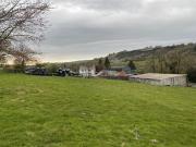
Barn Conversion Character Property
 7 pictures
Barn Conversion Character Property
SA62, Wolfscastle Haverfordwest Map
...land and countryside views, lies a development opportunity to create a charming character 3/4 bedroom cottage. The structure of the outbuilding is already present, with a private garden and allocated parking. This project has immense potential to cre...
- garden

4 bedroom property with land for sale
 12 pictures
4 bedroom property with land for sale
SA36, Glogue Map
...land and is located close to the beautiful Pembrokeshire National Park. This property offers ample space for a growing family to live a self-sufficient lifestyle and is well situated for reaching the towns of Cardigan, Narberth and Haverfordwest and...
- 4 rooms
- 1 bathroom

Land for sale
 3 pictures
Land for sale
CB6, Ely Map
...A single enclosure of arable land extending to approximately 6.10 hectares (15.07 acres) for sale by private treaty.Location -...ification Map as being Grade 3. The Soil Survey for England & Wales classifies the soils as being of the Evesham 3 Series, a...

5 Bedroom Land Commercial
 10 pictures
5 Bedroom Land Commercial
SA32, Carmarthen Map
...land. The property has the away from it all feeling, yet is positioned within easy access to the A48, approximately seven miles from the County town of Carmarthen providing everyday amenities and necessities. The property briefly comprises; entrance...
- 5 rooms
- parking
- garden

Land for sale
 9 pictures
Land for sale
CF41, Pentre Map
...land to the rear of Church Road, Ton Pentre that was formerly known as the band room and home to the World Famous Cory Band. The site has planning permission for the demolition of the current building and the construction of three dwellings with car...

Land for sale
 12 pictures
Land for sale
SY17, Powys Map
...Land to the southwest of Rhosfawr comprises 30.84 acres (12.48 hectares) of productive and versatile pastureland, situated les...ASIC PAYMENT SCHEMEThe land is registered with Rural Payments Wales; entitlements are not included in the sale of the land. ...

Farm land for sale
 2 pictures
Farm land for sale
NG21, Mansfield Map
...A single enclosure of agricultural land extending to 18.10 acres (7.33 hectares) with access off Cross Lane.Agricultural Land ...land is classified as Grade 3.The Soil Survey for England and Wales identifies the soils as belonging to the Cuckney Soil As...

Farm land for sale
 2 pictures
Farm land for sale
NG21, Mansfield Map
...A single enclosure of agricultural land extending to 14.26 acres (5.77 hectares) with frontage to both Warsop Lane and Blidwor...land is classified as Grade 3.The Soil Survey for England and Wales identifies the soils as belonging to the Cuckney Soil As...

Farm land for sale
 2 pictures
Farm land for sale
NG21, Mansfield Map
...A single enclosure of agricultural land extending to 11.27 acres (4.56 hectares) with access of Cross Lane.Agricultural Land -...land is classified as Grade 3.The Soil Survey for England and Wales identifies the soils as belonging to the Cuckney Soil As...

Farm land for sale
 2 pictures
Farm land for sale
NG21, Mansfield Map
...land extending to 32.49 acres (13.15 hectares) with a gated access of Blidworth Lane.Agricultural Land - According to Defra’s Agricultural Land Classification Map, all of the land is classified as Grade 3.The Soil Survey for England and Wales identif...

Farm land for sale
 2 pictures
Farm land for sale
NG21, Mansfield Map
...Two adjoining parcels of grassland extending to 43.19 acres (17.48 hectares) with access off Cross Lane.Agricultural Land - Tw...ad are excluded from the sale.The Soil Survey for England and Wales identifies the soils as belonging to the Cuckney Soil As...

